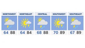
Widespread showers will gradually taper down, but not completely off through the evening as gusty winds ramp up.
Rain and storms move will continue to move from western to eastern Ohio through the evening. While some locally heavy showers are possible, we now expect the threat for severe weather to stay mainly near or south of the Ohio River.
Wrap around light showers linger into Saturday’s forecast with mostly cloudy skies and chilly temperatures! Not the best pool day to begin the holiday weekend. Highs on Saturday only reach the 50s and 60s.
Most of the showers taper off by late Saturday night with clearing skies and moderating temperatures on Sunday.
The rest of the Memorial weekend forecast is drier and milder with temperatures warming into the 60s to 70s by Monday, Memorial Day. So the weather improves later this weekend!
Rough waters
A Gale Warning is in effect through Saturday morning on Lake Erie with sustained winds up to 30 knots from the northeast. Some gusts may reach as high as 50 knots.
The largest significant waves will be 4-11 feet with a potential maximum wave height of 14 feet.
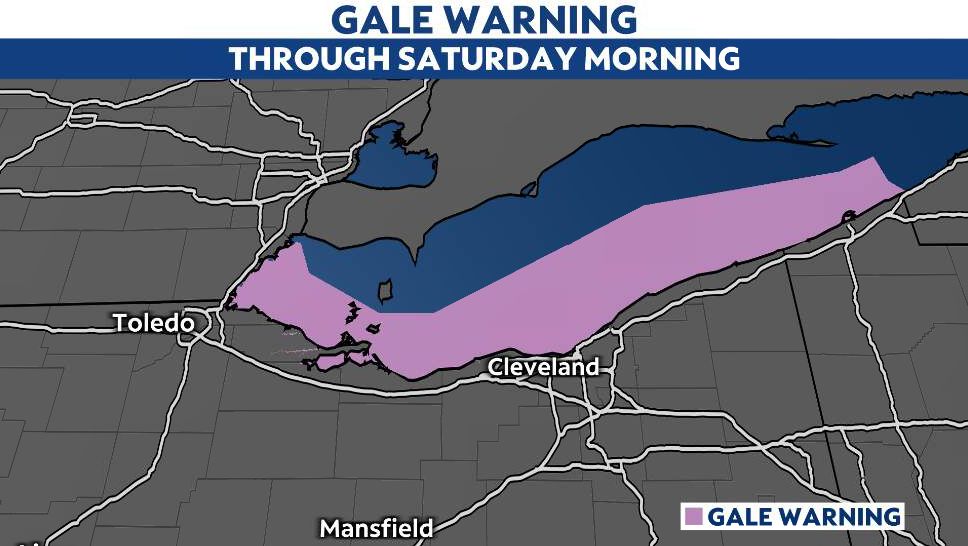
The largest waves expected through Friday evening.
Strong winds will cause hazardous waves which could capsize or damage vessels and reduce visibility. There is also the potential for lakeshore flooding along the southwest basin of Lake Erie.