Rain and likely a few storms continue through the afternoon before tapering off this evening.
What You Need To Know
- Another round of storms Tuesday
- The window for severe weather is late Tuesday
- Look for much cooler weather on Wednesday
Around midnight, another round of storms will move into western Ohio, with a possibility of isolated strong to severe thunderstorms. The chances of severe storms in Southwest Ohio has been trimmed back, but much of the state remains under a Marginal Risk (1/5) for severe weather.
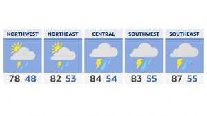
We’ll start off with scattered showers Tuesday morning, then another round of storms moves in late, bringing another chance of strong/severe storms mostly to Southeast Ohio.
The most likely threat of severe weather is damaging straight-line winds.
One last push of rain is present into early Wednesday morning, with clearing through the midday, but much cooler temperatures with highs only in the 50s and 60s.
Another round of rain rounds out the work week late Thursday into Friday.
Back to the cooler weather
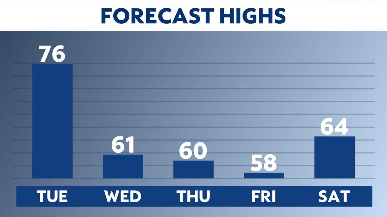
After starting the week in the 70s, we will see much cooler air coming in for the middle and end of the week.
-1)
Look at the temperature trend for Columbus this week.
We will see some cool afternoon highs in the upper 50s on Thursday.
The average high for Columbus right now is 69 degrees.