The week ahead looks busy with daily chances of showers and storms. Plus, temperatures warm back up after being below average this weekend.
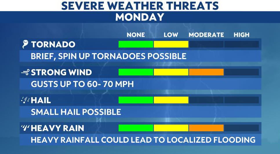
Jumping into Monday, most of the state has a Marginal Risk of severe weather. Once again, it is important to stay weather-aware and have your plan in place for severe storms.

Chances are isolated through the course of Monday but storms could produce gusty winds up to 60 mph, hail and heavy rainfall.
With heavy rain potential, localized flooding is also a concern, especially since we have daily chances of wet weather. The rain can add up quickly with any downpours!
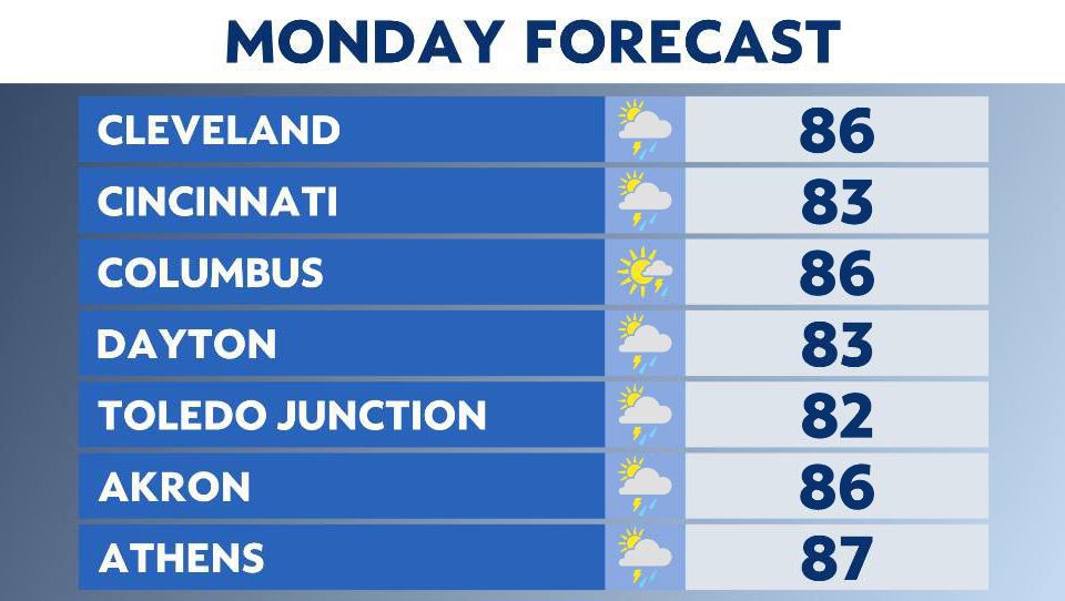
The best timing for storms is after lunchtime as temperatures approach the 80s. Highs on Monday reach the mid-80s across the state.
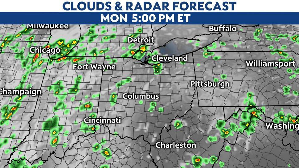
Pop-up storms come in the early afternoon on Monday with scattered chances later in the day.
Storms fizzle late Monday night.
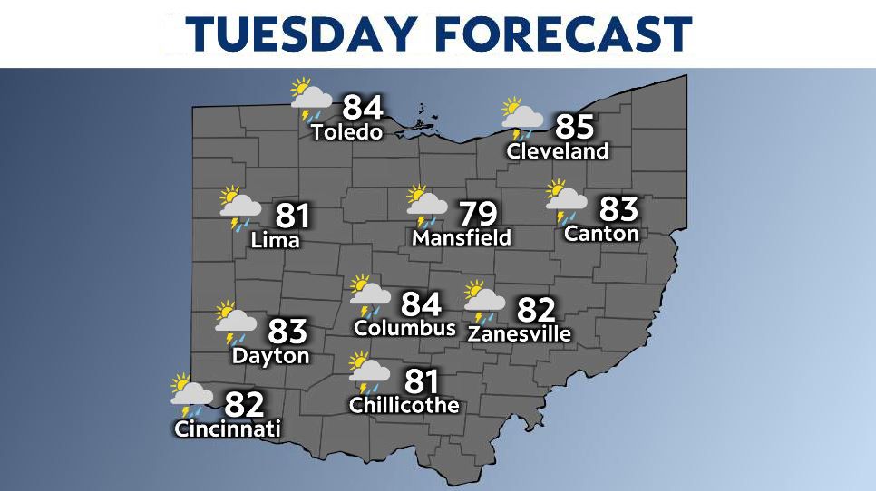
Tuesday begins mainly dry and quiet but rain and storm chances quickly return as we heat back up into the mid to upper 80s.
Watch for pop-up storms early/mid-afternoon and becoming scattered later in the day. Some storms could become severe once again.
The rest of the week is busy with daily chances of showers and storms. It’s a summertime pattern with mainly the activity of storms during the afternoon and evening hours with the hotter temperatures.
By Thursday highs push 90 again.

It won’t rain/storm each and every day but there’s a daily chance of it so be prepared and stay weather-aware with the latest Weather on the 1s forecast.