There are much needed rain chances on the way, but it may impact outdoor plans this Fourth of July weekend.
What You Need To Know
- Highs heat up with more humidity
- There are daily chances of showers and storms
- Not a washout this weekend, but unsettled weather expected
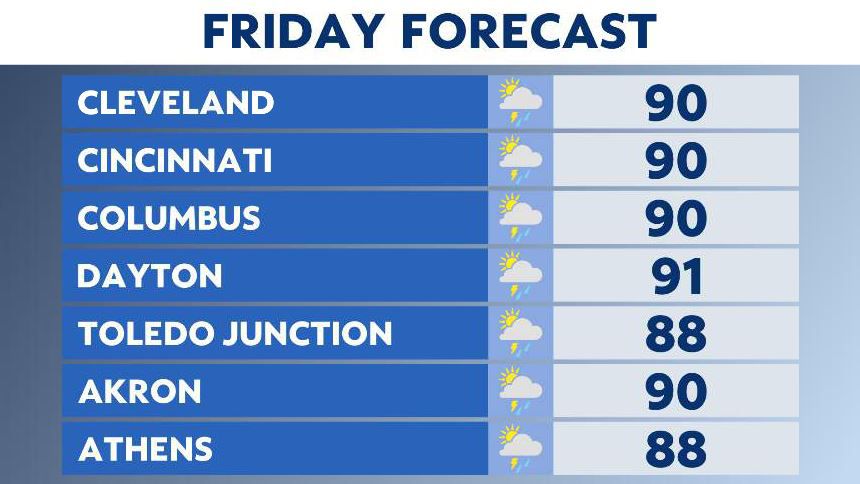
Starting Friday afternoon, evening storms develop along an approaching front. This front sits over central and southern Ohio, so those are the areas for the best chances of wet weather.

Temperatures push 90 degrees with higher dew points, and the heat index values range from the mid to upper 90s.
Late day storms fizzle Friday night, but they’ll develop again as the front lingers into Saturday afternoon.
Saturday has a better chance of storms throughout the afternoon and evening than Sunday. We won’t rule out some morning showers and storms Sunday, but we should dry out in the afternoon.

By the Fourth of July, Monday, an isolated storm is possible as temperatures are in the 80s.

So plan for chances of wet weather this weekend, but it won’t be a washout.