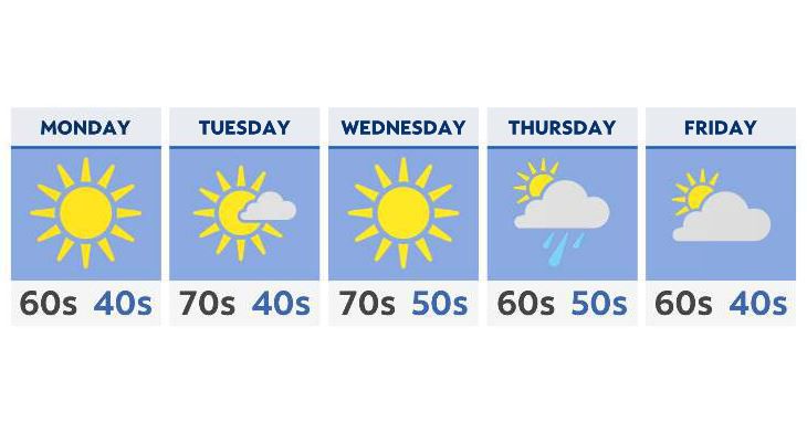
After a warm stretch of weather, more seasonable conditions finally return to Ohio.
The powerful cold front that moved through at the beginning of the weekend certainly left its mark across the Buckeye State, with 40s for overnight lows returning. As we head into the week ahead, expect much of the same overnight, with moderating daytime temperatures.
With winds shifting out of the west and southwest Monday through Wednesday, highs will hit the mid and upper 60s at first (where our averages are this time of year) Monday, followed by low to even middle 70s Tuesday and Wednesday.
High pressure dominates our forecast the first half of the week, so along with the warmer temperatures, we’ll see mostly sunny skies from lake to river, west to east.
By Thursday though, the ridge protecting us from any major systems breaks down, allowing our next front to move through. This will give us scattered showers and perhaps a rumble of thunder Thursday into Friday.
The end of the week will also give us slightly cooler, but seasonable highs; we’ll be back into the mid-60s.