I-70 will once again be a virtual dividing line for cloud cover as we head into Wednesday evening.
Ahead of our next front, increasing clouds and windy conditions will be felt across all of the state, with gusts out of the southwest nearing 40 mph overnight. Combined with the cloud cover, that will help keep temperatures in the 50s to near 60 for much of the state.
The next weather making front moves in Thursday, with big changes in store.
Highs Thursday will be in the 60s to near 70 early on before sharply dropping behind the front, with temperatures in the 30s and 40s by Friday morning. We’ll see a chance of showers statewide on Thursday, but don’t expect much in the way of anything measurable.
The bigger changes occur Friday and into the weekend, with a much colder air mass settling in over Ohio.
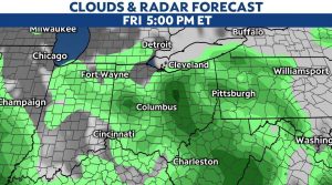
Under partly cloudy skies, Friday’s highs will struggle to get out of the middle 50s, with lows into Saturday morning well into the 30s. Frost is likely, along with even a flake or two near the lake! Temperatures could very well be near or at freezing for some.
Will We See Frost Saturday Morning?
Temperatures should drop to at least 36-38 degrees by early Saturday morning. We have higher chances of widespread frost if lows drop close to freezing.
Saturday morning’s forecast lows:
Cleveland: 37 degrees
Columbus: 34 degrees
Cincinnati: 35 degrees
Dayton: 34 degrees
Toledo: 35 degrees