It’s a mild, dry and breezy afternoon for most but isolated showers and storms are possible in western Ohio through the early evening. There’s a marginal risk for severe storms today is a Level 1 out of 5.
What You Need To Know
- Isolated storms are possible through early Friday evening
- Get your outdoor plans in early on Saturday
- Showers and gusty thunderstorms move in Saturday night
- It will be noticeably cooler on Sunday with spotty rain
The main threat with any severe storm that is able to pop up will be damaging winds.
Tonight will be mild and partly cloudy. After sunset the threat for any severe weather will diminish with the loss of daytime heating.
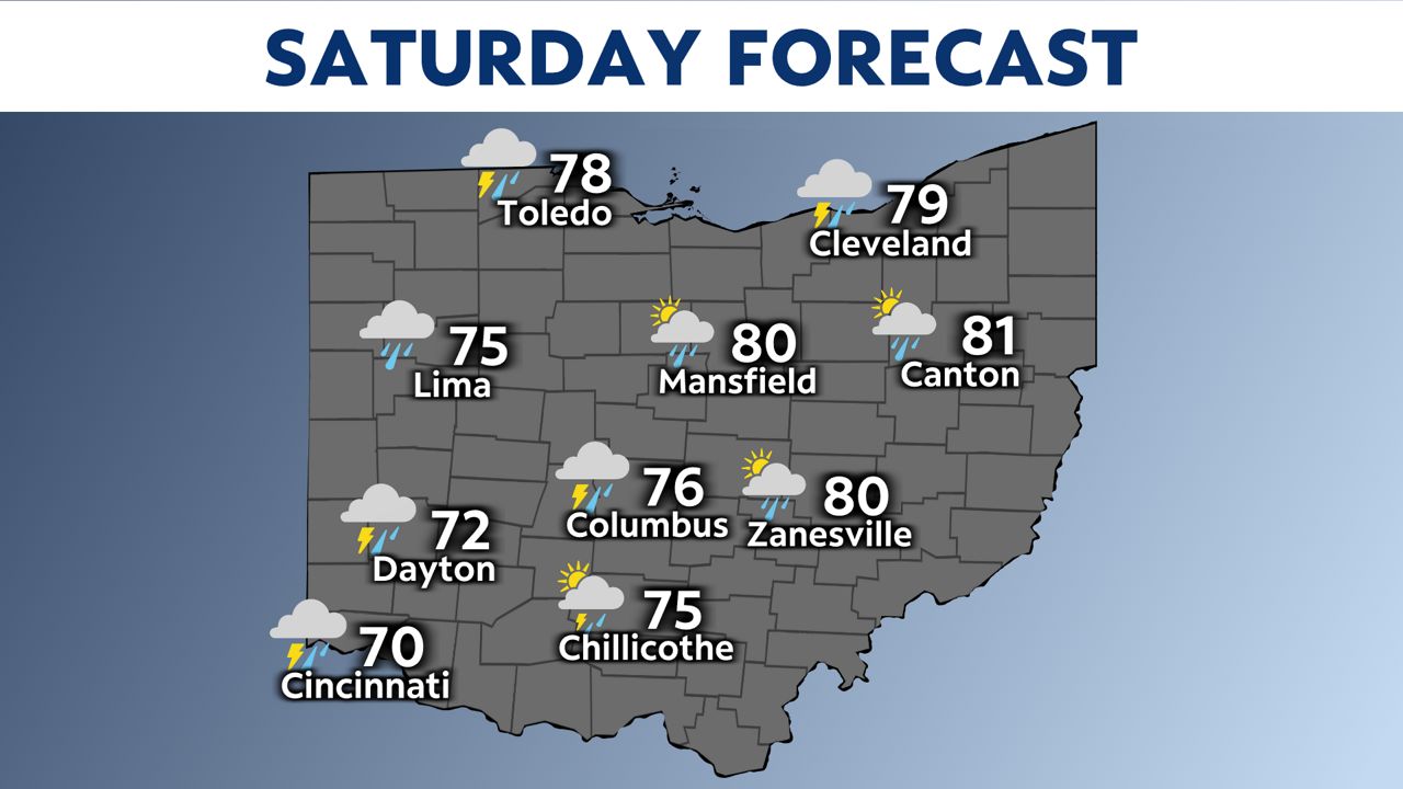
Saturday will start dry but end with rain and storms. If you have outdoor plans the earlier the better!
Saturday will also be another warm and above average afternoon in the 70s.
-1)
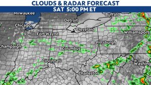
Here is your weekend timeline.
)
Another marginal risk covers more of the state Saturday afternoon and evening.
All modes of severe weather are possible late Saturday but right now it is still a low end threat with a marginal risk (Level 1 out of 5).
Storms will move in ahead of a strong cold front that will drop temperatures into the 60s on Sunday.
Rain will be spotty on Sunday.
Dry Pattern Ahead After Weekend
While we will see some active weather through the weekend, sunnier days are ahead!
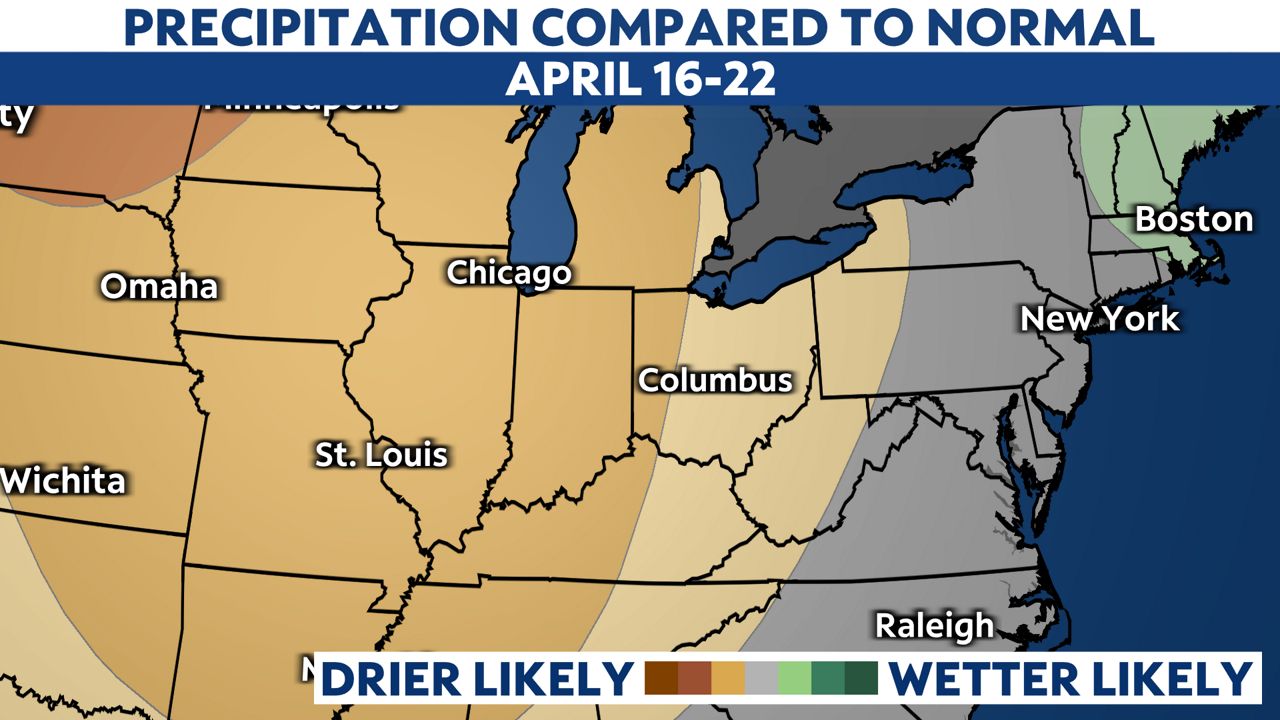
Take a look at our rain chances from April 16-22.
After Sunday, we will get into a drier than normal period.
If it gets too dry you might have to water!