Tropical Storm Isaias continues to move northwest while bringing impacts to the eastern Caribbean. Mainland U.S. impacts are possible this weekend, though high forecast uncertainty remains.
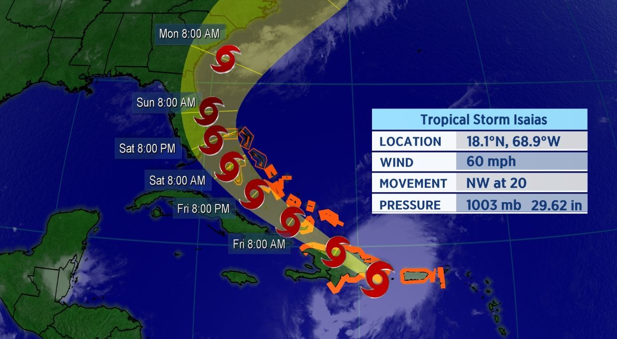
Forecast cone of Isaias as of Thursday morning.
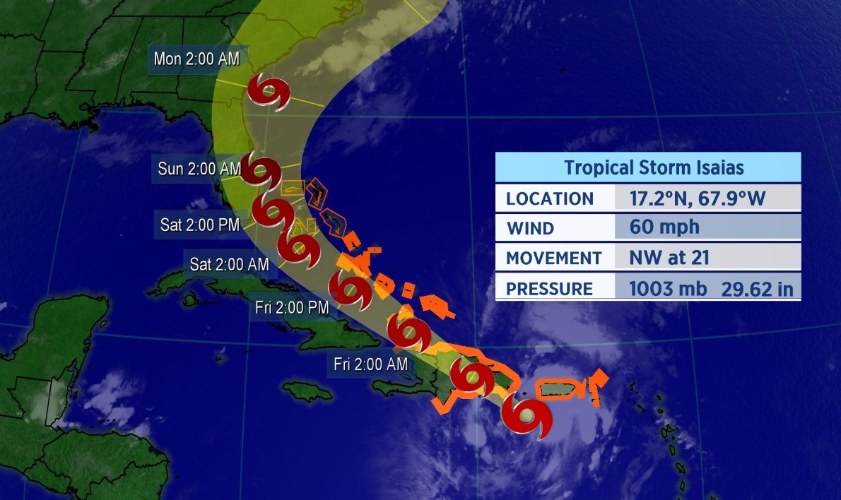
The storm is located about 100 miles WSW of Puerto Rico as of early Thursday morning, and is moving briskly to the northwest across the the eastern Caribbean. A ridge of high pressure located northeast of the storm is keeping its forward speed at about 20 mph which is relatively fast for a tropical system.
Isaias became the ninth-named storm of the Atlantic season, and therefore, it also became the earliest I-named storm on record. The previous record for the earliest ninth storm of the season was Irene, which formed on August 7, 2005.
If you’re wondering how exactly Isaias is pronounced, here’s a detailed guide on how to properly say it (along with all the other 2020 Atlantic storms. In short, Isaias pronounced over four syllables: ees-ah-EE-ahs.
The spaghetti models, a suite of computer forecast models overlayed on a map, show the storm is likely to gradually turn north as it moves westward across the Atlantic.
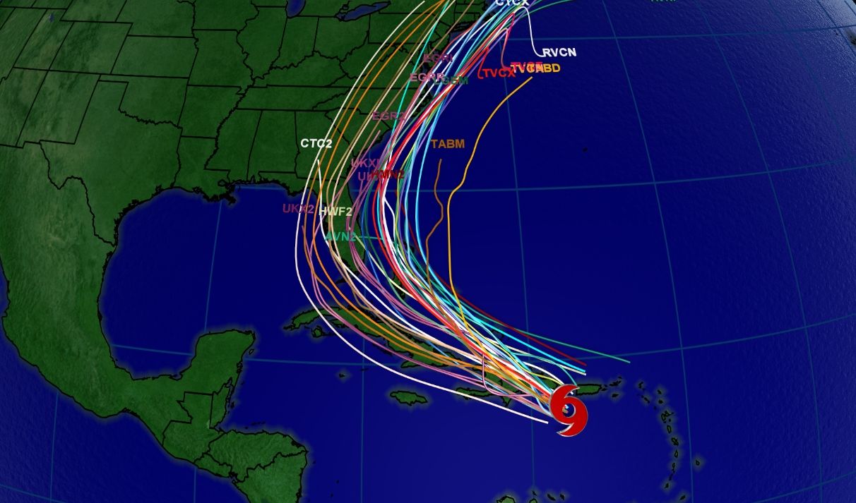
Spaghetti model tracks as of Thursday morning.
Tropical Storm Warnings are in place for much of the Caribbean, including the islands of Puerto Rico, U.S. and British Virgin Islands, St. Martin, St. Barthelemy, Saba and St. Eustatius, St. Maarten, the Dominican Republic, Haiti, Turks and Caicos, and the central and southeastern Bahamas. The northern islands in the Bahamas are under a Tropical Storm Watch.
Heavy rainfall and gusty winds will spread eastward from the Virgin Islands and Puerto Rico. Life-threatening flash flooding could occur.
A 52 mph wind gust was recorded on Saint Thomas in the U.S. Virgin Islands on Wednesday, and San Juan, Puerto Rico recorded a 44 mph wind gust as well.
Forecast Remains Tricky
Most computer forecast models first show Isaias weakening over the mountainous terrain of Hispanola. However, convection over Puerto Rico will help the surface center redevelop over the northern part of Isaias.
Although its long-term forecast is still highly uncertain, Isaias is projected to continue northwestward until the weekend. It will then turn north then northeastward towards the United States east coast.
The current forecast cone shows the potential for a landfall on Florida this weekend. Interests in Florida and throughout the southeastern U.S. should be closely monitoring this system.