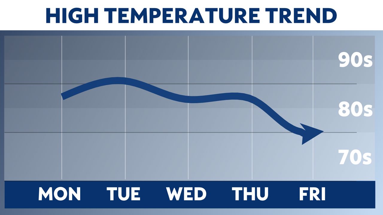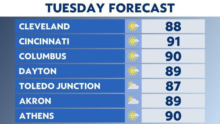
Hot, summer temperatures continue heading into Tuesday!
Isolated showers and storms that develop Monday fizzle out by tonight.

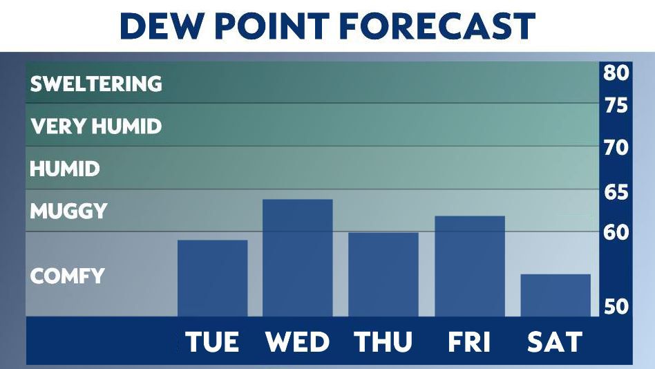
We’ll be back with a muggy morning as temperatures easily rise into the 70s by 9-10 am Tuesday. Then continuing to climb to almost 90 by the afternoon with very lower chances of rain or storms. Most of us remain dry with partly to mostly sunny skies.
The heat that builds tomorrow won’t last later this week as we cool off, and return back to normal highs for this time of year. A series of cold front pushes in mid/late week with widespread rain and storms chances.
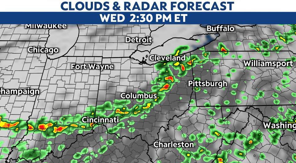
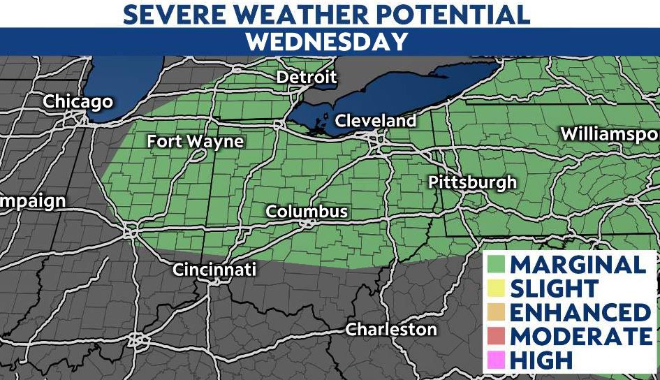
Wednesday scattered showers and storms are possible as the first front arrives into the Ohio valley. Some of these storms could be strong to severe with gusty winds and heavy downpours.
A marginal risk is in place for most of Ohio Wednesday for strong to severe storms, stay weather aware.
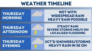
The front quickly exits Thursday, as rain chances are lower. It’s short-lived as our next system arrives for Friday. Our secondary cold front Friday brings the best chance of rain. In fact, most of the state is wet and cooler Friday with some storms possible.
Followed by wet weather late week, our Memorial Day weekend forecast is cool and comfortable and temperatures drop back to averages, and more importantly the humidity drops as well!
Cooling down To start Memorial Day weekend
Toward the end of the week, temperatures will drop closer to normal for this time of year across Ohio.