A well-deserved warm-up is on the way, with sunshine and highs well into the 60s for the upcoming week.
What You Need To Know
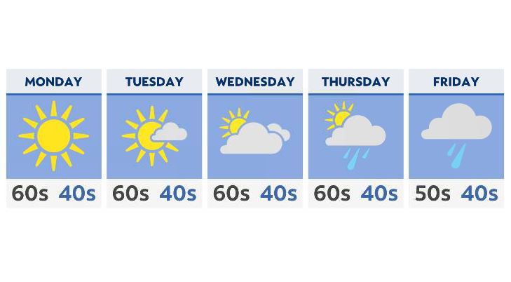
- A sunny and dry pattern will start the week ahead
- Highs will be in the 60s Monday through Wednesday
- Clouds increase by the middle of the week
- Rain returns Thursday and Friday statewide
High pressure keeps us mostly sunny and dry for the first few days of the week, with a light south breeze helping to keep temperatures back above average. Look for highs into the mid 60s Monday and Tuesday, with a few areas even closer to 70 degrees by Wednesday.
The ridge of high pressure breaks down a bit by Wednesday, with increasing clouds and a weak system that will bring a few scattered showers to the areas mainly north of I-70.
Clouds stay in the forecast for the end of the week, with a better chance of statewide showers Thursday and Friday.
At this point, a more powerful cold front will start to sweep through, pushing our temperatures down into the 50s– even below average by the time we get to Friday.
Rain will become a bit steadier by Friday afternoon, leading us into a wet start to next weekend.