Additional storms develop this afternoon around I-71 and move east/southeast into this evening.
What You Need To Know
- Today is humid and mild with scattered storms
- Isolated severe weather is possible through tonight
- Much cooler air comes in for Wednesday
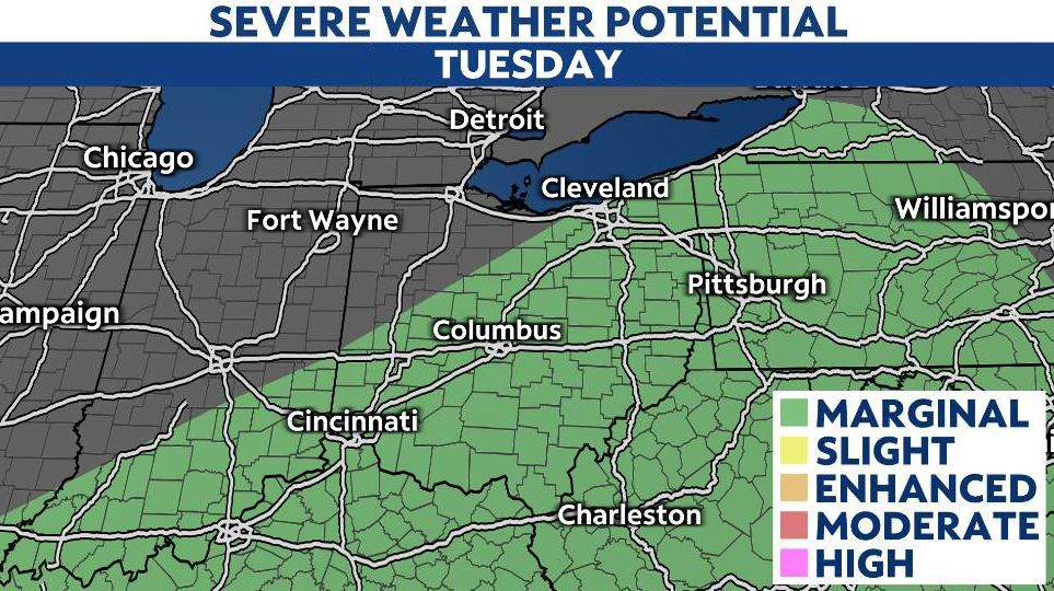
Areas we are watching for active weather will be right along I-71 from Cincinnati through Columbus and up into Cleveland, and E/SE of the interstate.

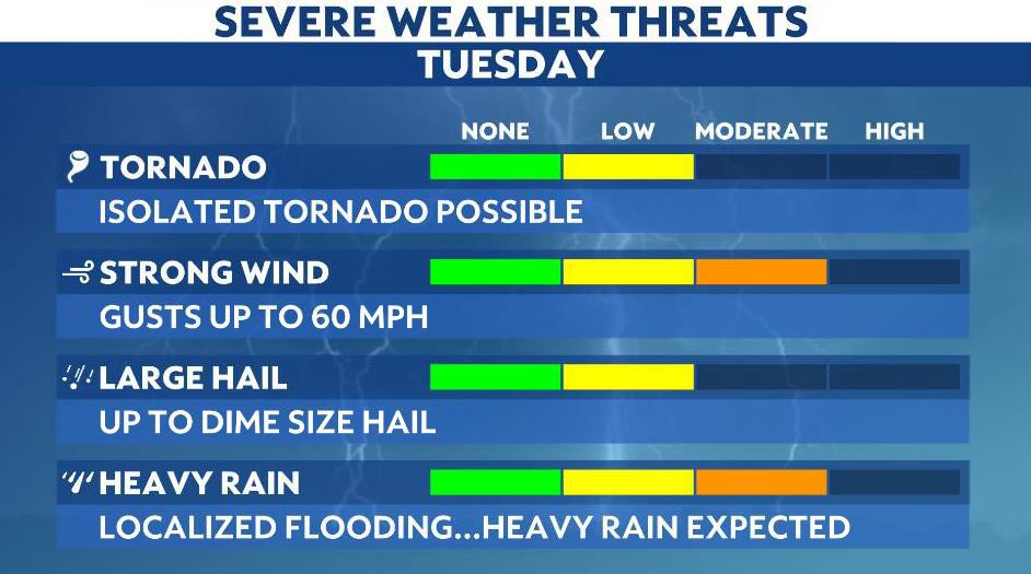
Main threats with severe weather today are large hail and damaging wind. We will continue to see rain/storms overnight into early Wednesday.
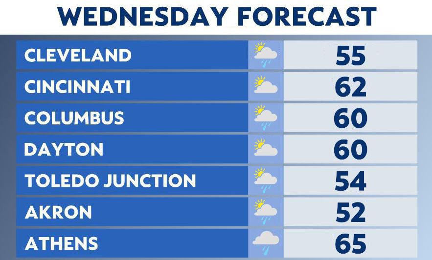
Morning showers possible but we’ll begin to see a break from the wet weather Wednesday afternoon. Highs are much cooler though in the 50s to 60s so get ready to keep the spring jacket close by as temperatures remain cool for most of the week!
Another wave of wet weather arrives late Thursday with another front. Rain and possible storms moves in Thursday evening into Friday.

Scattered showers linger during Friday as highs stay in the 50s and 60s.
Possible tornado Monday
Take a look at this photo!
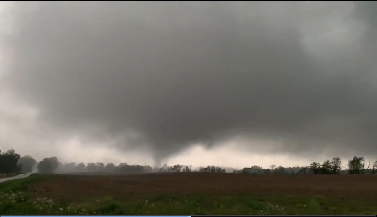
This is from video sent to us from Tyler Berry of Chasing Ohio.
This is from Mahoning county around 8:45 p.m. Monday.
The National Weather Service will determine if this is our first tornado touchdown of the season.
The storm became a tornado-warned storm as it moved east into Pennsylvania.