Isaias made landfall Monday night after restrengthening into a hurricane earlier in the day.
The storm came ashore with maximum sustained winds of 85 mph near Ocean Isle Beach, North Carolina, about 20 miles southwest of Wilmington.
Winds at Oak Island, NC gusted to nearly 90 mph as Isaias moved onshore.
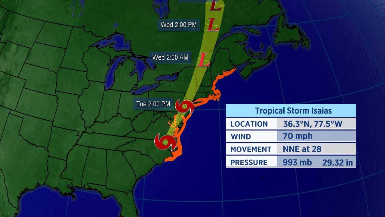
While Isaiasis no longer a hurricane, its impacts will still be widespread. Tropical storm warnings stretch all the way from Surf City, North Carolina to Eastport, Maine. This includes D.C., New York City, and Boston.
In addition, a storm surge warning is in place from Ocracoke Inlet, North Carolina to the North Carolina-Virginia border where water rise of up to three feet could take place.

Forecast track for Isaias.
While Isaias will gradually weaken as it tracks inland, it will still be impactful on Tuesday. Strong winds and heavy rainfall leading to flash flooding are likely for those in Isaias’ path. A few tornadoes are also possible in the rain bands.
North Carolina experienced heavy rain as Isaias came in.
Gov. Phil Murphy of New Jersey, declared a state of emergency effective 5 a.m. on Tuesday. He urged residents of the state to stay home and avoid traveling on roads if possible.
The New York City area should see tropical storm conditions arrive during the day Tuesday. On top of the heavy rain, wind gusts could exceed 50 mph at times.
Storm Won’t Stay Around Long
Isaias has already begun to move more quickly, now moving to the northeast at nearly 30 mph. That should limit the duration of the storm’s impacts.
However, even as Isaias weakens, it will still cause the potential for significant issues as it runs northward.
Impacts for Mid-Atlantic and Northeast are expected on Tuesday and could perhaps linger into Wednesday, mainly over New England.
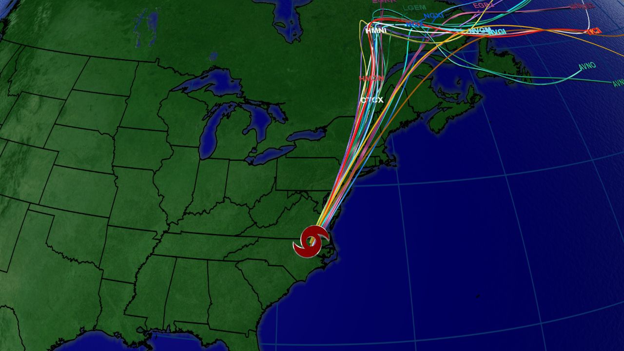
Spaghetti models for Isaias.
The spaghetti model plot shows that many computer forecasts show Isaias tracking over the Northeast megalopolis. Impacts will extend beyond those areas, though.
Isaias officially became the ninth-named storm of the Atlantic season and the earliest I-named storm on record. The previous record for the earliest ninth storm of the season was Irene, which formed on August 7, 200ay.
Isaias was the second hurricane of a busy to-date 2020 Atlantic season.
If you’re wondering how exactly Isaias is pronounced, here’s a detailed guide on how to properly say it (along with all the other 2020 Atlantic storms. In short, Isaias pronounced over four syllables: ees-ah-EE-ahs.
Keep checking in for the latest updates.