Our spring snow is on the way! A mix of light rain/wet snow is moving through northern Ohio early this morning. This will not be our “main feature.”
What You Need To Know
- Scattered light rain/snow today north
- Rain changes to snow late tonight
- 1-3 inches of snow by daybreak Wednesday for many
- Cold, brisk and unsettled through Wednesday night
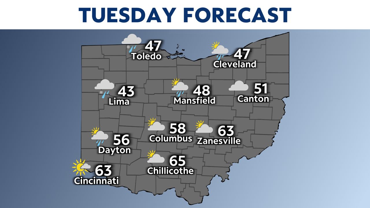
Highs today will be very different from north to south.
-2)
Temperatures will stay in the 40s north, but will get into the 60s south where we see dry skies and some sun.
By 3 p.m. this afternoon, rain and snow will move into northwest Ohio.
-1)
The heaviest snow will be in northwest and west-central Ohio (Toledo, Celina & Bellefontaine).
Pockets of snow of 4 inches is possible there.
Overall, we are talking about 1-3 inches for most.
The bad news is the snow will stick to grassy and elevated areas and cars. The good news is it won’t have as much of an impact on travel because road temperatures are too warm for that.
Even as heavy snow will taper off west to east on Wednesday morning, we will stick with the winter theme tomorrow. It will be chilly and brisk with cold wind chills. Skies will likely not dry out either. We will see occasional showers through the evening.
It will be very cold Wednesday and Thursday nights. We could see some record lows in the northern Ohio.
Returning to spring
Highs will recover into the 50s on Thursday.
Friday will have sunshine and highs in the 60s.
)
Our next mild day will be Monday with highs in the middle 60s.