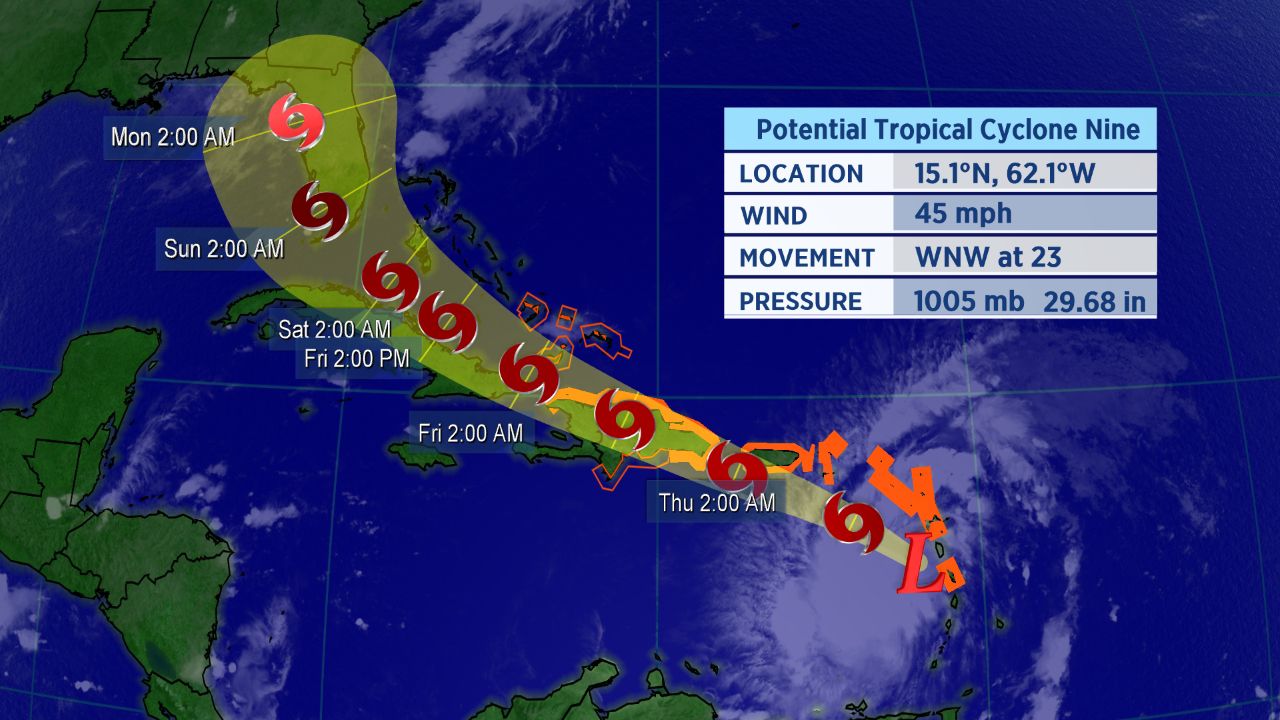
The tropical system we have been monitoring in the Atlantic was deisgnated as Potential Tropical Cyclone Nine on Tuesday and has moved into the Caribbean.
Potential Tropical Cyclone Nine has had some trouble developing into an organized system, but is expected to become more defined on Wednesday as it quickly moves through the eastern Caribbean.
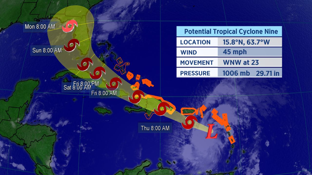
Forecast track for Potential Tropical Cyclone Nine.
A Potential Tropical Cyclone means, in part, that the National Hurricane Center believes the storm has a high probability of turning into a tropical cyclone, and forecast cones, tropical alerts and more can be issued before a tropical cyclone officialy develops.
The next storm on the Atlantic Hurricane list is Isaias. If it does develop, it would become the ninth named storm of the Atlantic season and the earliest I-named storm on record. The current record for the earliest ninth storm of the season is Irene, which formed on August 7, 2005.
If you’re wondering how exactly Isaias is pronounced, here’s a detailed guide on how to properly say it (along with all the other 2020 Atlantic storms.
As of Wednesday morning, the poorly defined center of Potential Tropical Cyclone Nine had passed the Leeward Islands and entered the Caribbean Sea.
The spaghetti models, a suite of computer forecast models overlayed on a map, show the storm is likely to gradually turn north as it moves westward across the Atlantic.
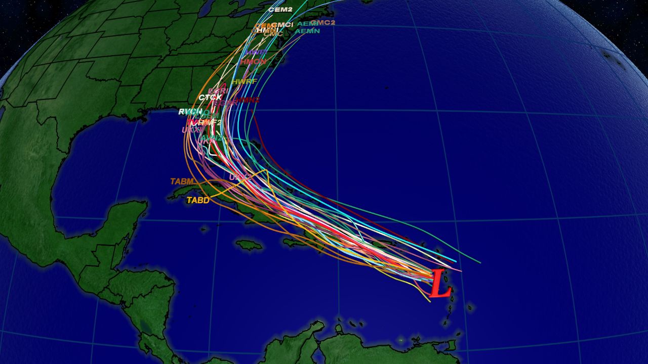
Spaghetti model plot from Wednesday morning.
Tropical storm warnings are in place for much of the Caribbean, including the islands of Puerto Rico, U.S. and British Virgin Islands, Antigua, Barbuda, Montserrat, St. Kitts, Nevis, and Anguilla, Guadeloupe, Martinique, St. Martin, St. Barthelemy, Saba and St. Eustatius, St. Maarten, the Dominican Republic, and Haiti.
Heavy rainfall and gusty winds will spread to the Virgin Islands and Puerto Rico on Wednesday into Thursday.
Most computer forecast models show the storm slowly strengthening into a tropical storm on Wednesday, although the long-term forecast is still highly uncertain. The track will depend on where exactly the center of the system forms, and how much it interacts with islands will affect its strength.
The current forecast cone shows the potential for a landfall on Florida this weekend. Interests in Florida and throughout the southeastern U.S. should be closely monitoring this system.