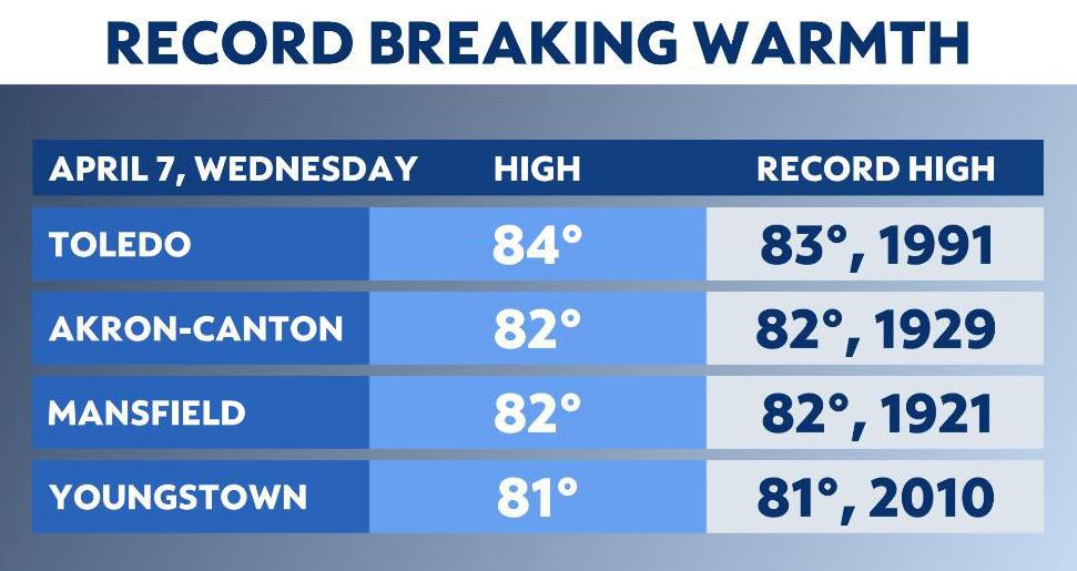
Just a week ago- April started with record cold temperatures then seven days later record heat! Wednesday several cities reached 80s, either for the first time, or second time this year. Here are the cities that broke/tied record highs yesterday!
What You Need To Know
- Some storms Thursday afternoon could have heavy downpours and gusty winds
- Several systems will keep rain chances going through the weekend
- Next week our temperatures look much more seasonable

Changes arrive today as a cold front moves into our area. You’ll need the rain gear and along with your severe weather plan as storms fire later today we have the threat for strong/severe storms.
This morning a few showers are possible before lunchtime especially in western and central Ohio. As the front edges closer and we heat up expect chances to increase during the afternoon with scattered showers and storms.
Some storms could produce heavy rainfall and gusty winds up to 60 mph, and we can’t rule out a brief tornado. Overall our severe weather threat is low, but it is always important to stay ahead of the storm and stay weather aware.
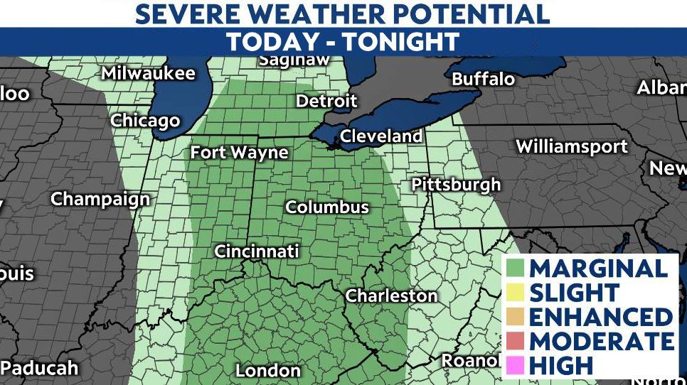
Stronger/severe storms could develop anytime after 1-3 PM and storms linger through this evening and into tonight pushing into eastern and northeastern Ohio. Most of the state is under a marginal risk today (1/5) with primary threats: wind, and heavy rain.
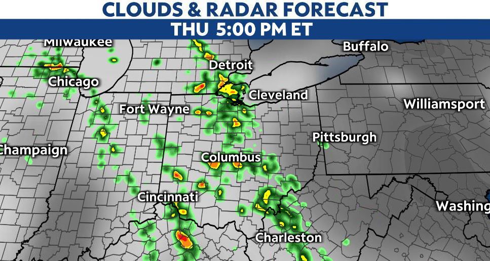
Some lingering showers possible into Friday’s forecast for northern Ohio, while the rest of the state is mainly dry with highs in the 70s.
Soaking rain moves in for Saturday and we’ll be dodging rain chances through parts of this weekend as temperatures also cool down starting Sunday. Expect a cooler trend into early next week with more seasonal temperatures returning to Ohio.
Severe Weather One Year Ago
One year ago, we had severe storms that produced both tornadoes and straight line winds up to 90 mph!
On April 8, 2020 storms developed in the afternoon in Indiana. They moved into the Cincinnati area in the evening and carried over into April 9.
Tornadoes were confirmed in: Hamilton, Brown, Clinton and Clermont Counties along with some golf-ball sized hail.
19 tornadoes were confirmed between Ohio, Kentucky and Indiana.
)
In addition to rotating storms, straight line winds estimated at 80-90 mph caused tree and structural damage in Clermont and Highland Counties.