Isaias is forecast to re-strengthen into a hurricane today before making landfall in the Carolinas this evening.
A hurricane warning runs from the South Santee River in South Carolina to Surf City, North Carolina. In addition, a storm surge warning is in place from Edisto Beach, South Carolina to Cape Fear, North Carolina, Pamlico and Albemarle Sounds, and Oregon Inlet, North Carolina to the North Carolina-Virginia border.
Tropical storm warnings are in place from Altamaha Sound, Georgia to South Santee River, South Carolina; Surf City, North Carolina to the Merrimack River in Massachusetts; Pamlico and Albemarle Sounds; Chesapeake Bay; tidal Potomac River; Delaware Bay; Long Island and Long Island Sound; and Martha’s Vineyard, Nantucket, and Block Island.
While Isaias brought generally minor impacts to Florida in a glancing blow on Sunday, the storm is forecast to re-strenghten into a hurricane and deliver more widespread and direct impacts to the East Coast. Even inland areas will experience the threat of heavy rain.
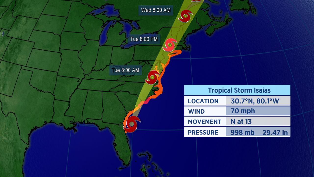
Forecast track for Isaias.
Along the track of Isaias, there is a threat of strong wind, heavy rain and localized flooding, and storm surge in coastal areas. As is often the case with landfalling hurricanes, a few tornadoes are also possible.
The New York City area should see tropical storm conditions arrive during the day Tuesday. That’ll include wind gusts over 40 mph and heavy rain.
Storm Won’t Stay Around Long
As Isaias moves up the coast, its forward speed will increase. That should limit the duration of the storm’s impacts.
However, even after Isaias’s winds weaken, it will still cause the potential for significant issues as it runs northward.
Impacts for mid-Atlantic and Northeast are also likely on Tuesday and perhaps linger into Wednesday.
“I expect the worst conditions along the North Carolina coast to occur late Monday through Tuesday morning,” Spectrum News meteorologist Matthew East said. “A few feet of storm surge looks likely in some areas, dependent on exactly where the center tracks.”
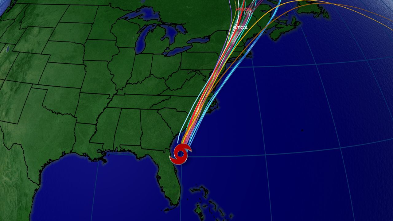
Spaghetti models for Isaias.
The spaghetti model plot shows that many computer forecasts show Isaias going from eastern North Carolina toward New York City. Impacts will extend beyond those areas, though.
Isaias officially became the ninth-named storm of the Atlantic season and the earliest I-named storm on record. The previous record for the earliest ninth storm of the season was Irene, which formed on August 7, 2005.
The storm brought heavy rain and flooding, along with wind damage, to parts of the Caribbean. Hurricane warnings for the northwestern Bahamas were dropped Sunday morning as the storm moved away.
Isaias was the second hurricane of a busy to-date 2020 Atlantic season.
If you’re wondering how exactly Isaias is pronounced, here’s a detailed guide on how to properly say it (along with all the other 2020 Atlantic storms. In short, Isaias pronounced over four syllables: ees-ah-EE-ahs.
Keep checking in for the latest updates.